Discover more about ‘Our Block’

ralph allen bequests bath chronicle and weekly gazette thursday 23 august 1764
Ralph Allen bequests, Bath Chronicle and Weekly Gazette – Thursday 23 August 1764

I have just updated the ‘Our Block‘ page. Ian & Susan Parsons, at 121 Church Road, kindly lent me the deeds that they have in their possession.

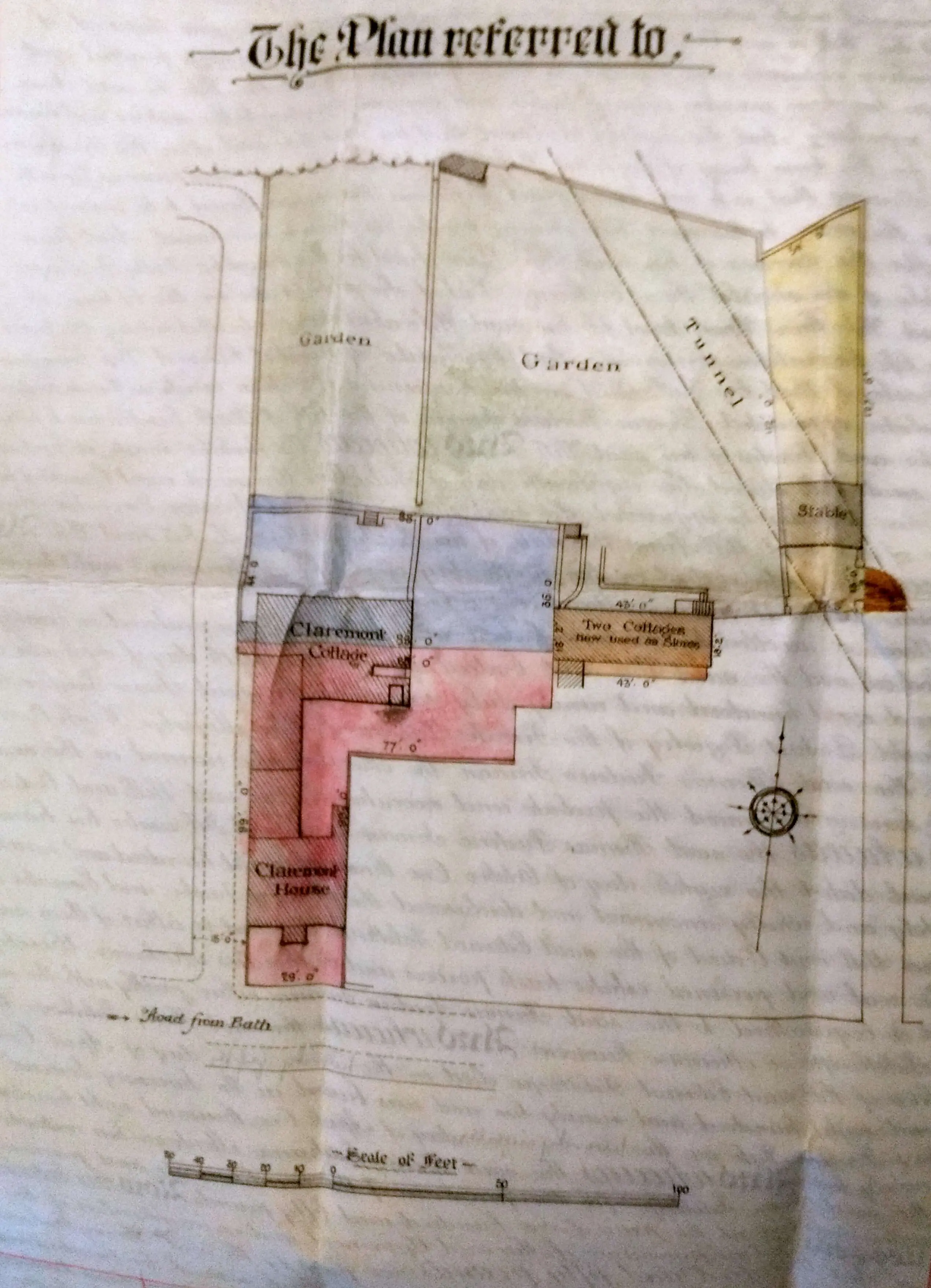
Interestingly, most of them were for Claremont House, 109 Church Road. They also encompass Claremont Cottage, 107 Church Road, Claremont Lodge, 119 Church Road as well as Ian & Susan’s property, 121 Church Road, which has been called Rosemere.

Solicitors’ filing systems are a never ending wonder, but I guess that as Claremont House was broken up into flats 121 became the ‘logical’ place to put all it’s history. I’m glad about that as old deeds can be a small mine of information. All the properties aforementioned were traded as one entity for a long time.

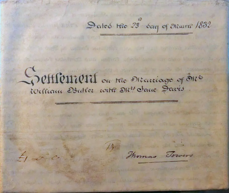
As stated, solicitors’ filing systems are a never ending wonder and another interesting inclusion was a deed from 1768.

It seems to be a ‘cuckoo’ as it relates to London Road properties and transactions by Lewis Clutterbuck, who was a lawyer, member of Bath City Council 1753 – 57 and town clerk, 1757 – 76. He was also mentioned in Ralph Allen’s will receiving a £100 bequest. His family owned Newark Park, at Ozleworth near Wotton-under-Edge. Why it’s with the deeds for Claremont….

Delving through the documents shows that Claremont was constructed c 1805 – 1806 along with 113 – 117 and Hopecote (which was, originally 3 properties).

We know that 119 was originally 2 properties. It became clear that at some time between 1878 and 1893, 121 was built as a block of stables.

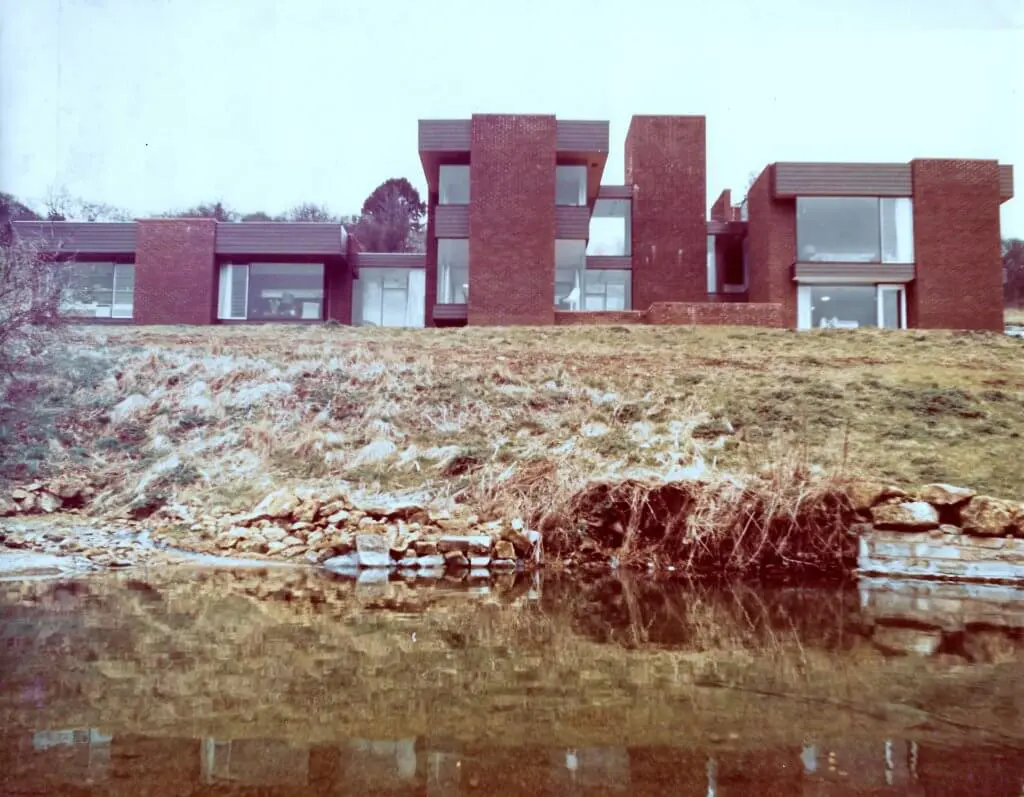
The current structure is due to substantial alterations. The documents show that permission for ‘provision of a mansard roof’ was granted 4 Dec 1973, the ‘erection of a single storey extension to the rear,’ on 17 Aug 1978, the ‘erection at first and second floor level over existing garage’ on 16 Aug 1979 and the ‘erection of a garage’ on 17 Dec 1981.

extract from deed of 13 july 1893
Extract from deed of 13 July 1893

Related Images:

The unquestionably ubiquitous Benjamin Wingrove

In another tenuous coincidence I have discovered that Benjamin Wingrove (1773 – 1840), who has his own page on this site, and was an attorney, land speculator, agriculturalist and road builder is the 1st cousin 1x removed of the wife of the husband of the 7th great-aunt of our son-in-law. I said it was tenuous!

The Wingroves were a family based in North Bradley until Benjamin Wingrove (1693-1768) moved to Bath He married Ann Pitman (1703 – 1796) in 1730. They had nine children in 16 years.

His children also prospered. Francis (1733 – 1795) became a well known baker.

His daughter Mary (1742 – 1803) married John Hensley (1737 – 1802) a coachmaker based in Broad Street.

Another son William (1745 – 1786) was a brewer and died quite young but married Martha Whittaker (1737 – 1795) a daughter of Thomas Whittaker (1702 – 1760) of Bratton, Wiltshire.

The Whittakers were clothiers, fullers, corn and sheep farmers. After her husband died Martha became a pump mistress at the baths.

The pump mistresses were widows of good repute. They needed to have reasonable means as the annual rent was £840 but the potential was that they could make a good profit and set themselves up for retirement.

The covenant was with Mayor, aldermen and citizens and the duties included opening and shutting the pump rooms, keeping the rooms tidy and fit for the reception of Nobility, Gentry, Inhabitants and others and paying all taxes. It related to baths and vaults at the Kings & Queens Baths, Hot Baths and Cross Bath.

martha wingrove pumper bath chronicle and weekly gazette thursday 9 july 1795
Martha Wingrove, Pumper – Bath Chronicle and Weekly Gazette – Thursday 9 July 1795

Anthony Wingrove (1748 – 1798) became a Captain in the 34th Regiment of Foot seeing action in Canada and the West Indies and dying in Dominica.

anthony wingrove becomes captain kentish gazette tuesday 1 april 1794
Anthony Wingrove becomes Captain – Kentish Gazette – Tuesday 1 April 1794

Another daughter, Elizabeth (1749 – 1822) married Robert Forman (1741 – 1792) an attorney.

His son John Wingrove (1739 – 1790) ran the Marlborough Tavern, 35 Marlborough Buildings, Walcot, Bath and the Fox & Hounds, Walcot Street. He married Anne Blatchly (1740 1822) on 14 February 1764. They had six children in 11 years, but 4 died in infancy or childhood. His eldest son John (b 1765) became a ribbon weaver in Bristol.

wingrove marlborough tavern coach horses bath chronicle and weekly gazette thursday 2 may 1793
Wingrove, Marlborough Tavern coach horses – Bath Chronicle and Weekly Gazette – Thursday 2 May 1793
john wingrove fox and hounds bath chronicle and weekly gazette thursday 6 december 1787
John Wingrove, Fox and Hounds – Bath Chronicle and Weekly Gazette – Thursday 6 December 1787

His other surviving son was Benjamin Wingrove (1773 – 1840)  who appears in this site and whose page I have ‘upgraded’.

Related Images:

Curo cable car, simple clanger or huge cock up?

I’ve added a section about the Curo cable car plan that flew across the sky between 2015 and 2017.

Curo were starting the development of Mulberry Park and having some ‘issues’ with their Foxhill master plan – which was mentioned in last month’s blog ‘Black hats or blunderers‘. 

The Curo cable car plan was abandoned after negative feedback during the consultation process. What I find interesting is why it was put forward? Did Curo really believe that it would receive planning permission in Bath’s World Heritage Site?

Curo are members of the World Heritage Site steering group which also includes:

The World Heritage Site steering group  is involved with producing the Bath World Heritage Site Management Plan.

A quick review of this would have shown the obstacles that the Curo cable car plan would have faced in getting any planning approval. Presumably why they said they intended to bypass the usual planning system and go straight to the Secretary of State for Transport.

Even that, one suspects, would have been a challenge. As the Bath World Heritage Site Management Plan makes clear:

"Government guidance on protecting the Historic Environment and World Heritage is set out in National Planning Policy Framework and Circular 07/09. Policies to protect, promote, conserve and enhance World Heritage properties, their settings and buffer zones are also found in statutory planning documents. The Bath and North East Somerset Local Plan contains a core policy according to which the development which would harm the qualities justifying the inscription of the World Heritage property, or its setting, will not be permitted. The protection of the surrounding landscape of the property has been strengthened by adoption of a Supplementary Planning Document, and negotiations are progressing with regard to transferring the management of key areas of land from the Bath and North East Somerset Council to the National Trust."

Further reading would have shown:

"The site boundary is the municipal boundary of the city. This covers an area of approximately 29 square km. As noted in chapter 1, Bath is exceptional in this respect as the World Heritage inscription in almost every other city worldwide covers only a part of the urban area and not the entire settlement. Venice and its lagoon is the closest European comparator.

The property was inscribed in 1987 without a boundary map, which was not uncommon at that time. The description of the ‘City of Bath’ was taken to mean that the boundary encompassed the entire city and it was managed accordingly. This boundary was subsequently confirmed by letter (dated 17 October 2005) from the UNESCO World Heritage Centre."

and:

"Bath remains a compact city, contained largely within the hollow in the hills as previously described. The city does not have significant ‘urban sprawl’ and high quality built development directly adjoins high quality landscape at the urban edge. The skyline is predominantly characterised by trees or open pasture. The green hillsides provide a backdrop to the urban area and are visible from most of the city centre. Bath is well provided for in terms of parks and open spaces, with the River Avon cutting through the city centre providing natural beauty and sense of calm. All of the above contribute to an impression that the city is smaller than it actually is."

and: 

"The Green Setting of the City in a Hollow in the Hills

42. The compact and sustainable form of the city contained within a hollow of the hills
43. The distinct pattern of settlements, Georgian houses and villas in the setting of the site, reflecting the layout and function of the Georgian city
44. Green, undeveloped hillsides within and surrounding the city
45. Trees, tree belts and woodlands predominantly on the skyline, lining the river and canal, and within parkland and gardens
46. Open agricultural landscape around the city edges, in particular grazing and land uses which reflect those carried out in the Georgian period
47. Fingers of green countryside which stretch right into the city"

as well as various maps: 

world heritage site extent 300x209
World Heritage Site extent
green belt 300x205
Green belt
conservation area 300x205
Conservation area

So, why was the Curo cable care plan put forward? It would seem that it was most unlikely to get planning permission – unless there’s something I don’t know about.

Related Images:

A complete shaggy dog story

shaggy dog brunswick place combe down bath chronicle and weekly gazette thursday 11 september 1873
Shaggy dog, Brunswick Place, Combe Down – Bath Chronicle and Weekly Gazette – Thursday 11 September 1873

Things that are new on the site recently are a small section on Combe Road – something of a shaggy dog story given that it, unfortunately, has so little of consequence in it. But one can’t just make things up for a site like this.

There’s also a brief article on Mulberry Park the the 48 acre (19 hectare) Ministry of Defence site started by the Admiralty and purchased by Curo for £50 million in 2013.

It’s probably the third largest project on Combe Down since the Admiralty set up site at Foxhill for World War 2 and since Ralph Allen set up his stone quarrying operations in the 1720s and built Prior Park in the 1730s.

There’s also a great YouTube video on the Combe Down quarries page that is an animation of a quarry crane produced by Mark and Ben Jenkinson to illustrate the Corsham Institute’s Bath Stone exhibition in autumn 2016 at Cranes at Work. 

Cranes were an essential part of the quarrying process. They were used to lift the blocks of stone cut from the working face onto carts, which were then pulled to the surface by horse or donkey; or later, by small locomotives.

The main structure of the cranes was wooden, with metal gearing and fixings. They could lift blocks of around 5 tonnes.

A crane would be erected in a new working area until all the stone within its reach had been quarried. Then it would be dismantled, moved along to a new area, and re-erected to continue working.

quarry crane
[media-credit name=”Copyright © Mark Jenkinson” link=”http://www.boxpeopleandplaces.co.uk/underground-quarries.html” nofollow=”true” align=”aligncenter” width=”1000″][/media-credit] Quarry crane

Related Images:

Unforgettable photos and maps

unfinished prior park chapel in about 1855 rev francis lockey 1796 1869 300x229
Unfinished Prior Park chapel in about 1855, Rev Francis Lockey (1796 – 1869)

I have spent some time adding to the galleries for Prior to Now and there are over 1,000 images of people, buildings and activities on Combe Down on the site.

The earliest photographic images are of Prior Park in about 1855 by the Rev Francis Lockey (1796 – 1869). 

Rev Lockey and his family lived in Swainswick near Bath, in a house known then as Swainswick Cottage and now known as the White House.

Amazingly Lockey’s photographic studio (now a conservatory) survives virtually intact at his former home. The studio has been confirmed as being the earliest known surviving photographic studio by the Science Museum.

Rev Lockey began experimenting in 1849, first using paper negatives and later glass plates developed using the calotype photographic process, which had been patented by William Henry Fox Talbot (1800 – 1877) in 1841.

central combe down in 1899 somerset revised 1899 published 1904 1024x430
Central Combe Down in 1899 -Somerset, Revised 1899, Published 1904

The galleries that have been added are:

As well as these galleries I have also added two maps. They are very large image files that take some seconds to download on even a fast connection but, once loaded and if all works as it should you can click on the image and zoom into it.

Related Images:

Entry Hill from the Romans to Frank Lloyd Wright

fosse way that ran diagonally across england from the roman cities of lincoln lindum colonia to exeter isca dumnoniorum in the south west after passing through bath aquae sulis 300x267
[media-credit name=”By Neddyseagoon at English Wikipedia” link=”https://commons.wikimedia.org/wiki/File%3AFosse_Way.JPG” align=”alignright” width=”300″][/media-credit] Entry Hill is part of Fosse Way that ran diagonally across England from the Roman cities of Lincoln (Lindum Colonia) to Exeter (Isca Dumnoniorum) in the South West after passing through Bath (Aquae Sulis)

Entry Hill – the name tells you pretty much all you need to know.

For generations this was the main route to and from Bath to the South West, and was a part of the Fosse Way, that ran diagonally across England from the Roman cities of Lincoln (Lindum Colonia) to Exeter (Isca Dumnoniorum) in the South West after passing through Bath (Aquae Sulis).

Although Entry Hill and the road network was important there was little population or housing either on Entry Hill itself or on Combe Down above it.

Even in the 1930s the area from The Forester pub to the old Frome Road Workhouse had little housing.

So, it’s not surprising that there are few listed buildings in the Entry Hill area nor those that are there are mostly revised farm or quarry buildings as that was went on in the area until very recently.

The surprise comes in the form of Valley Spring, the only Grade II listed building in the Bath city area, out of well over 2,500, that is a 20th century building.

valley spring early 1970s 13 1024x797
Valley Spring early 1970s

The house was built, between 1968 and 1969, for John Basil Womersley (1927 – 1979), managing director of Bath Cabinet Makers and Arkana, which specialised in contemporary and curvilinear tulip furniture.

It was designed by his brother Charles Peter Womersley (1923–1993). Farnley Hey, the first house he had designed for his brother won the RIBA bronze medal in 1958, and has been described as “one of the best demonstrations of the influence of Frank Lloyd Wright (1867 – 1959) in Britain”.

Valley Spring is one of Bath’s (and Combe Down’s) unknown jewels. It tries to follow Frank Lloyd Wright’s philosophy of organic architecture. To my mind it succeeds.

Related Images:

More memories from Frank and an 1832 marriage settlement

butler davis deed dated the 23rd day of march 1832 settlement on the marriage of mr william butler with mrs jane davis
Butler Davis deed dated the 23rd day of March 1832, Settlement on the Marriage of Mr William Butler with Mrs Jane Davis

This time I am writing about more memories from Frank and an 1832 marriage settlement

a couple sleeping in a morrison shelter during the second world war 300x226
[media-credit name=”By Ministry of Information Photo Division Photographer, Public domain, via Wikimedia Commons” align=”alignright” width=”300″][/media-credit] A couple sleeping in a Morrison shelter during the Second World War

That’s Frank Sumsion who tells us about Senior School and the outbreak of the Second World War.

Those days were certainly interesting with the Bath Blitz in 1942, having to use Morrison shelters to protect oneself from the bombing and with every item of food and drink was rationed.

It’s all very different from today. He also tells us about starting work just after his 15th birthday, working at  Combe Down Waterworks, being in Bath Civil Defence Service, a a succession of different motorbikes, working at a mushroom farm and meeting his future wife Jane.

The Settlement on the Marriage of Mr William Butler with Mrs Jane Davis. William Butler it was who, along with William Harrold built Isabella Place after Thomas Maude, 2nd Viscount Hawarden (1767 – 1807) started to sell the estate of Ralph Allen (1693 – 1764) that he had inherited from his father Cornwallis Maude, 1st Viscount Hawarden to pay his father’s debts. His mother had been Mary Allen, Lady Maude (1732  â€“ 1775), his father’s first wife, and the niece of Ralph Allen who built Prior Park Mansion.

The marriage settlement between William Butler and Jane Davis.

A marriage settlement was very necessary in those days for a wealthy lady like Jane Davis – her assets in the settlement were £808 16s 11d which is now worth about £976,900.00. Once again things were very different from today. At the time an unmarried woman had the right to own property and make contracts in her own name but, upon marriage, a woman’s legal rights and obligations were subsumed by those of her husband. Married women did not have any rights due to the legal fiction, called coverture, that a husband and wife are one person. Once a woman married she had no claim to her property as her husband had full control and could do with it whatever suited him!

This did not start to change until The Married Women’s Property Act of 1870.

I hope you enjoy more memories from Frank and an 1832 marriage settlement

Related Images:

The magic of adverts and street furniture

There are two pages in the site that I have not yet mentioned in this blog – adverts and street furniture.

I find both really quite interesting as they speak about the culture of the time just by their design and look as well as their purpose.

However one looks at it, for better or for worse, adverts change and reflect society and so sometimes become interesting themselves.

The local adverts that I have found that mention Combe Down or Monkton Combe generally fit in the ‘factual anOd banal’ category but are sometimes no less interesting for that in the context of local history.

Some of the adverts, like the one for Combe Down Brewery are clearly well ‘ahead of their time’ and one wonders who it was that created it.

Others, such as the one for afternoon tea at Mayfield are so basic one wonders how well they worked, but, perhaps they are historic proof of less is more?

afternoon teas at mayfield bath chronicle and weekly gazette saturday 5 november 1921 300x140
Afternoon teas at Mayfield – Bath Chronicle and Weekly Gazette – Saturday 5 November 1921
combe down brewery in 1862 300x272
Combe Down Brewery 1862

Street furniture such as post boxes, phone boxes, benches, fountains, watering troughs, memorials and everything else that has become so common now, such that now there are appeals to reduce some of it to stop motorists and others becoming confused, has exited since Roman times but it’s really only in the last 200 years or so that it has expanded from mile markers and the like.

Sometimes one has to look quite hard to find it like the waterworks plate, which many will, perhaps find ugly but which I think is quite charming.

Others, such as the turnpike marker from 1827 are obviously charming and clearly well built to have survived for 190 years.

turnpike marker on combe road 300x300
Turnpike marker on Combe Road
combe down waterworks plate on bradford road 300x298
Combe Down waterworks plate

So, adverts and street furniture, things to look out for.

Related Images:

At The Old Vicarage – more tea Vicar?

cleveland bridge bath in 1830 engraving by fp hay 300x212
Cleveland Bridge Bath in 1830 – engraving by FP Hay

I realised that I haven’t mentioned The Old Vicarage and the clergy of Combe Down in the blog.

That’s an error as  as the house was designed by Henry Edmund Goodridge (1797 – 1864) who designed one of Bath’s iconic monuments: Beckford’s Tower. He also designed one of the world’s earliest retail arcades The Corridor in central Bath.

He designed Cleveland Bridge at the site of a Roman ferry crossing, linking the A4 London Road with the A36. It’s a cast iron arch bridge with lodges like miniature Greek temples at each corner and was was built in 1827 by William Hazledine. Oh, and he had also designed Holy Trinity church.

The Old Vicarage was used by the vicars of Combe Down until 1974 when it was sold to Dr John (Jack) Ferens Turner (1930 – 2002) and his wife Dr Anne Curtis Turner (née Pyke) (1939 – 2006).

rev g w newnham
Rev G W Newnham

There have been some interesting ministers living at The Old Vicarage, such as Rev George William Newnham (1806 – 1893) who was Vicar from 1842 – 1877. He was married 3 times and had 17 children!

His third wife Harriette Helen White (1820 – 1889) set up what became the Institution for Idiot Children and those of Weak Intellect at Rockhall House on Combe Down. He also started the Combe Down allotments.

There was Rev Carr Glyn Acworth (1842 – 1928) who was Vicar from 1877 – 1890. He was also was married 3 times but he had no children.

Rev Alfred Richardson (1853 – 1925) was vicar from 1902 – 1914. After he retired he wrote: An historical guide to Monkton Combe, Combe Down and Claverton with Rev David Lee Pitcairn (1848 – 1936) who was vicar of Monkton Combe from 1883 – 1914 and also a great grandson of Arthur Guinness (1725 – 1803) – the brewer.

Ven Albert Bushnell Lloyd (1871 – 1946) was vicar from 1930 – 1933. He  was a missionary and Archdeacon of Western Uganda. His written works include: Uganda to Khartoum (1906), In Dwarf Land and Cannibal Country (1907), Dayspring in Uganda (1921) and Apolo of the Pygmy Forest (1923).

Related Images:

Remarkable residents of Combe Grove area and Summer Lane

thomas sturge cotterell
Thomas Sturge Cotterell

Recently I added information about the Combe Grove area and Summer Lane. By the Combe Grove area I mean Shaft Road and Brassknocker Hill.

On Brassknocker Hill that means that Combe Hill House and Combe Grove Lodge are covered and on Shaft Road that means that Lodge Style, Combe Grove Farm, Combe Grange and Ivy Cottages.

In Summer Lane , Quarry Vale and De Montalt House are covered. De Montalt Mill is covered elsewhere with its history before 1850 here and its history after 1850 to modern times here.

The person who most caught my eye was Patrick Young Alexander (1867 – 1943) who lived at De Montalt House. He lived an interesting life – probably helped by the fact that his father left him a very large legacy – but was also an aeronautical pioneer fascinated by the prospect of heavier than air flight, an enthusiastic balloonist and meteorologist.

Another interesting person is Thomas Sturge Cotterell (1865 – 1950).

He commissioned Lodge Style from Charles Francis Annesley Voysey (1857 – 1941) in 1909. Cotterell was General Manager of the Bath Stone Firms and a Bath Councillor, one of the main movers behind the Bath Pageant of 1909, an Alderman and Mayor of Bath in 1930.

He also set up the Bath Corps of Honorary Guides. His uncle was Jacob Henry Cotterell (1817 – 1868) a land surveyor responsible for the 1852 map of Bath that appears regularly on this site.

The most frustrating area when researching the Combe Grove area and Summer Lane was Quarry Vale. 

I knew it would be difficult to find published information about the inhabitants for they were working class people – not middle class or higher and the ‘social medium’ of the day, the newspaper, did not really follow their world unless criminality or scandal was involved.

This gives a distorted image of working people’s lives. So I decided to take a look at the census, give a flavour of the range of occupations, pick out a few that were well represented and give a thumbnail sketch of those, as well as try to find some news clippings.

It’s not what I would have wanted to publish, but, if the information is not there….

Anyway, I hope you enjoy reading more about  the Combe Grove area and Summer Lane.

Related Images: