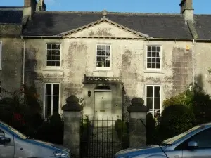
Dial House, De Montalt Place, Combe Down – one of the listed buildings
I have just added a page for Listed Buildings on Combe Down and in Midford and Monkton Combe divided into 15 areas which are in a rough circle as follows:
I was just looking at the Hunt & Co. and Silverthorne directories for Bath and Bristol for 1848 and 1846 respectively and thought it would be interesting to see what went on in the village around then – what was it like on Combe Down around 1846 – 1848? Who is mentioned? What trades and professions?
The problem is that, unlike later Kelly’s directories that locate a place and then show the people living there plus their occupations etc. these earlier directories are alphabetical and by class, so it’s not so simple to get an idea of what was going on.
Luckily, in this age of the internet you can find ‘electronic’ copies of most things, which makes it easier to do a search and then……
The results are below and provide an interesting snapshot of some of the people who lived and worked here.
I find a number of things interesting, compared to today.
For example the use of ‘nobility and gentry’ and people describing themselves as ‘gent’.
The boarding and day schools situated in private houses.
The fact that there were actually shops in the village (!) – no cars or supermarkets then.
Additionally, given the total population of 1,600 – 1,750 there are, unlike say the old telephone directories, actually very few people listed.
One other thing is the blacksmith. In Silverthorne’s of 1846 it is George Humphries but by Hunt & Co of 1848 it is Harriett Humphries – presumably his wife or daughter. But, was she the owner or did she actually smith? It would be interesting to know.
The census’ for 1841 and 1851 also give a picture and are shown below the directory findings.
Some interesting things were going on with property on Combe Down around this time.
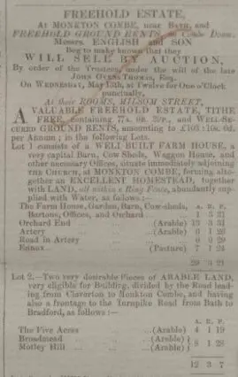
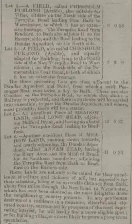
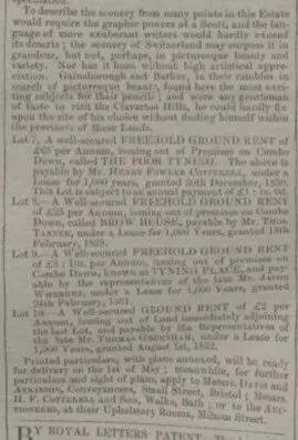
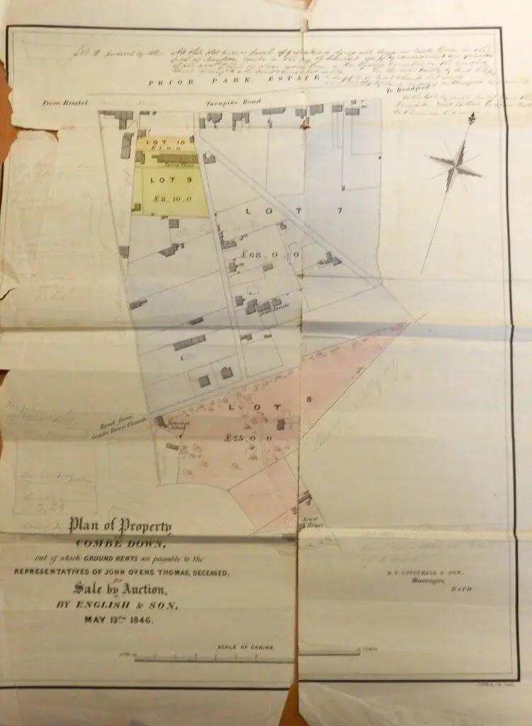
John Ovens Thomas (1778 – 1836), the eldest son of John Thomas, the owner of Prior Park had died 10 years earlier but in 1846 his trustees decided to sell much of the land he had inherited from his father as well as some of his ground rents. The land, as can be seen from the estate sale notice below included the farm next door to St. Michael and All Angels Church at Monkton Combe, a number of fields near the Dundas Acqueduct and Midford Brook as well as ground rents for the Tyning Road area, The Brow, and Tyning Place.
John Ovens Thomas estate sale – Bath Chronicle and Weekly Gazette – Thursday 16 April 1846
It also included the land from North Road to Church Road as the map below shows, The map also gives a really good idea of what this area of Combe Down was like in 1846.
Map of Combe Down plots for sale from estate of John Oven Thomas in 1846
Hunts & Co 1848
Nobility, Gentry, &c.
Baskett Mrs. Sarah, 6, De Montalt place, Combe down
Payne John, overseer of the parish of Monkton Combe, Park villa, Combe down
Radburn George, quarry master, Combe down
Rawlings William, Carriage Inn, Combe down
Ricketts Charles, carpenter & joiner, Combe down
Salter Job, 1, Priory cottages, Combe down
Spence Samuel, Hadley Arms, and quarry master, Combe down
Stinnard & Ford, quarry masters, Combe down
Stodart John, 2, Claremout buildings, Combe down
Sumsion Isaac, quarry master, 1, Park place, Combe down
Vincent William, boot & shoe maker, 9, Cheap street — p. r. Combe down
Whitaker William, boot and shoe maker, Combe down
Wren Thomas Jay, short hand writer, and stationer, Combe down
Churches
Trinity, Combe down. — Sunday, 11 morn. and 6 even. Sacrament administered the first Sunday in the month. Rector, Rev. George Newnham. Curate, -Rev. D. Topham.
It was the sort of strange coincidence that seems to call for an alliterative mass market magazine headline, something like “Mattingley makes Maria match” or “Strange Scammell story sensation” but ‘Combe Down cousin coincidence’ got the vote.
You may be wondering what I’m on about, or, even, what I’m on?
Actually, it’s quite simple but a bit strange. I discovered, quite by chance after we have lived here for 31 years, that my (half) brother Phil Scammell’s 1st cousin 4 times removed, used to live next door, at 117 Church Road Combe Down, in 1870/71.
Not only that but her son, Robert Henry Mattingly, was born there in 1870 and her husband, Robert George Mattingly, died there in 1871.
Strangely, I wrote about them, Robert and Maria Mattingly, in my book and on this site, saying “Robert (b.1841) and Maria Mattingly (1841 – 1921) lived at 117 in 1871. Robert had been a joiner but no more has been discovered about them.”
That was because I didn’t know then that Maria was Maria Scammell (1840 – 1901).
That I discovered when David Gardner, an expert on the Scammell family tree, contacted me to gently point out some errors in the family tree I publish and update from time to time.
He also commented ‘Maria c 1841 who died 1901 Barnet her spouse was Robert G Mattingley’. At the time a very soft chime went off in my head, but I did not, then, make the connection.
Then about a week later, considering what to post about for Prior to Now this month, I was paging through the site and saw Robert and Maria Mattingly. The surprise and the connection were instant and, after doing some more digging into the family tree on Ancestry I was able to confirm that they are, indeed, the same people. It’s a bit weird somehow.
Maria was the daughter of Joseph Scammell (1801 – 1875) and Maria Slade (1805 – 1895), who were both born in Edington, Wilts.
Joseph had been a farmer in Ringwood according to the 1841 census, a rail timekeeper at Eling St Mary in the 1851 census but who, by the 1861 census gave his occupation as a “farm bailiff of 160 acres employing 4 men and 2 boys” and was living at 26 Bearfield, Bradford on Avon. Maria had been born whilst he was at Ringwood and in 1864 married Robert George Mattingley (1841 – 1871) in West Derby on Merseyside.
Robert had been born in Chippenham, was a joiner and had, presumably, found work up there. He died aged only 30 at 117 Church Road, Combe Down.
Robert and Maria had 3 sons, Henry Nelson Slade Mattingley (1865 – 1946), George Elliot Mattingly (1867 – 1887) and Robert Henry Mattingly (1870 – 1895).
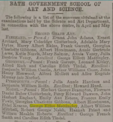
George Elliott Mattingley – Bath Chronicle and Weekly Gazette – Thursday 13 August 1885
We know that George Elliot Mattingly was born in Liverpool and attended the Bath Government School of Art and Science from an entry in the Chronicle for 1885.
Robert Henry Mattingly was born at 117 Church Road, Combe Down and died when he was only 25. He was an auctioneer’s assistant and lived at 23 Milsom Street, the ground floor of which was Lloyds Bank. He left £127 6s according to probate, a considerable sum for such a young man.
Henry Nelson Slade Mattingley was also born in Liverpool but was baptised in Chippenham. In the 1881 census his occupation is Apprentice Bookseller. He married Edith Mary Butterfant (1866 – 1946) in 1890 and in the 1891 census when he was living in Lakenham his occupation was given as ‘Manager, Fancy Goods Dept.’.
He moved to Barnet by 1901 and became a Commercial Traveller. When he died at Middleton on Sea in 1946 he left £9,919 14s 6d worth between £367,500.00 (commodity value) and £1,846,000.00 (income or wealth value) today, depending on how it’s calculated.
He and his wife had 2 children Nelson Robert Eric Mattingley (1899 – 1986) and Geraldine Mattingley (1900 – 1976). Nelson Robert Eric Mattingley is shown as a schoolboy boarder at Monkton Combe Junior School, Combe Down, Bath in the 1911 census.
Maria died in 1901, leaving £747 8s 8d. She had home in Bath, at 3 George Street, and in Barnet, presumably to be near her remaining son Henry Nelson Slade Mattingley.
So, there you go, nothing earth shattering just a coincidence but one I, at least, found quite interesting.
Just seeing what an area looked like 100 or more years ago on and Ordnance Survey map can give real insights into the place.
Of course very old maps tend to be either somewhat inaccurate or have little detailed data because of their scale.
Even so they can be interesting and the history of the maps themselves is almost as fascinating.
As most people know the mapping of the British Isles has been led by the Ordnance Survey, which was, effectively, started after the Jacobite rising of 1745.
In 1747, Lieutenant Colonel David Watson proposed a map of the Highlands to subjugate the clans.
King George II charged Watson with making a military survey of the Highlands under the command of the Duke of Cumberland.
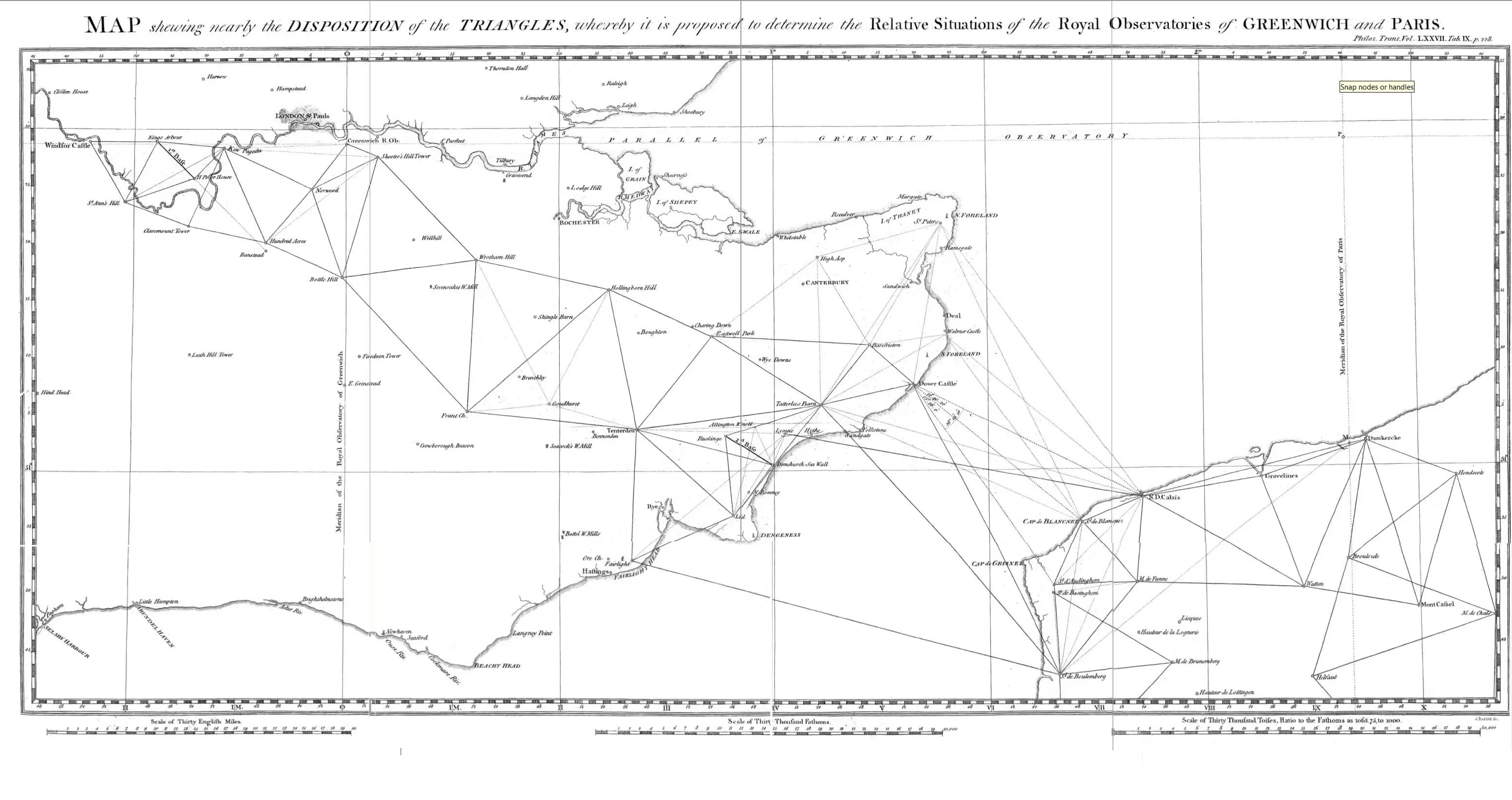
This eventually led to the Principal Triangulation of Great Britain (1783–1853), a project carried out between 1784 and about 1853 at the instigation of senior surveyor General William Roy (1726–1790) and to the creation of the Ordnance Survey.
Anglo French survey of 1784-1790 proposed mesh by William Roy – Scanned from Philosophical Transactions of the Royal Society of London vol77: 188–226 1787
In 1801, the first one-inch-to-the-mile (1:63,360 scale) map of Kent was published.
During the next twenty years, roughly a third of England and Wales was mapped at the same scale under the direction of William Mudge (1762 – 1820).
Somerset was mapped by 1817. It was tough work, Major Thomas Colby (1784 – 1852) walked 586 miles in 22 days in 1819.
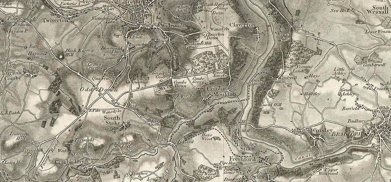
The map of that covers Combe Down, that was published in 1817, shows surprisingly little change has occurred . Development of housing , yes, but the shape and the main features are very recognizable.
Combe Down Ordnance Survey first series 1817
This work is based on data provided through www.VisionofBritain.org.uk and uses historical material which is copyright of the Great Britain Historical GIS Project and the University of Portsmouth.
To provide the best experiences, we use technologies like cookies to store and/or access device information. Consenting to these technologies will allow us to process data such as browsing behavior or unique IDs on this site. Not consenting or withdrawing consent, may adversely affect certain features and functions.
Functional
Always active
The technical storage or access is strictly necessary for the legitimate purpose of enabling the use of a specific service explicitly requested by the subscriber or user, or for the sole purpose of carrying out the transmission of a communication over an electronic communications network.
Preferences
The technical storage or access is necessary for the legitimate purpose of storing preferences that are not requested by the subscriber or user.
Statistics
The technical storage or access that is used exclusively for statistical purposes.The technical storage or access that is used exclusively for anonymous statistical purposes. Without a subpoena, voluntary compliance on the part of your Internet Service Provider, or additional records from a third party, information stored or retrieved for this purpose alone cannot usually be used to identify you.
Marketing
The technical storage or access is required to create user profiles to send advertising, or to track the user on a website or across several websites for similar marketing purposes.