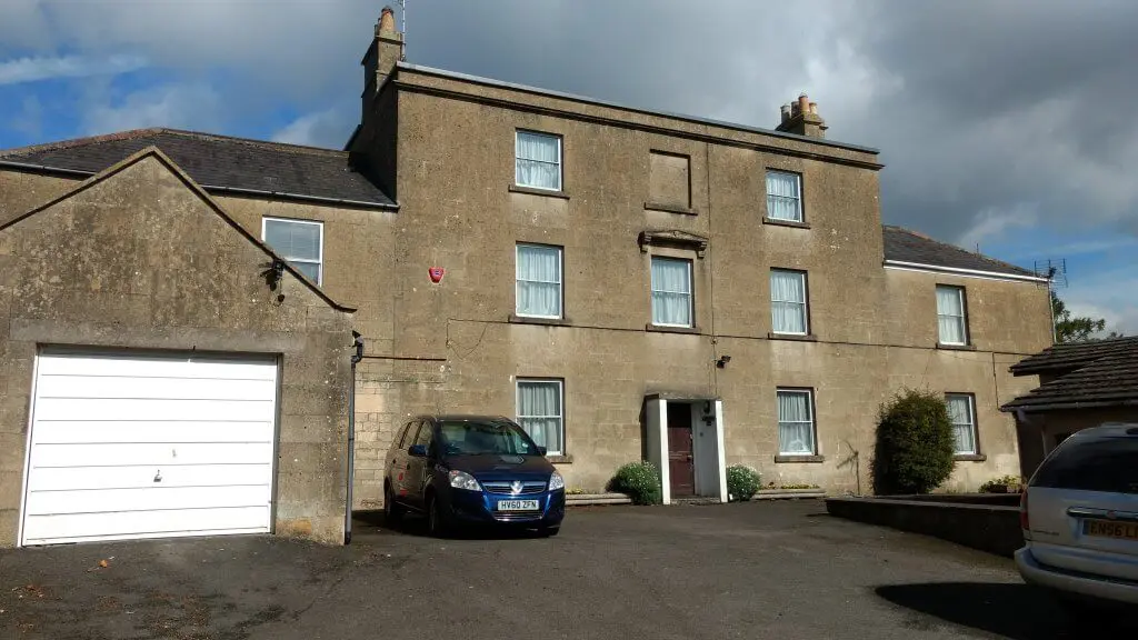
Our block covers the Owners and occupants of 109, 113, 115 & 117 Church Road, Combe Down.
Significant facts about the rest of Combe Down and Monkton Combe does what it says on the tin!
If you’ve read the Introduction then you will know that when I started this, the idea was just to find out when our house was built.
Somehow, that expanded as a project to look at Combe Down, as per the map in the intro.
Clearly researching the older, larger houses, and the people that lived there, takes some time, so what you see is what you get for the rest of the area as it gets done.
Rather than use every resource I have relied more on the census for 10 years snap shots, filling in with directories when it seems sensible to me so to do.
Obviously that means that some of the fine detail will be lost, but it’s really not feasible to mention every person who lived somewhere in every year. Eventually I hope to fill in some of the gaps.
Isabella Place 1800 – 1900
Isabella Place, like Claremont House, 113 – 117 Church Road and Hopecote (originally 1 – 3 Claremont Buildings) was built about 1805.
Claremont House, 113 – 117 Church Road and 1 – 3 Claremont Buildings were all, originally 2 storeys and ‘2up 2down’…
Isabella Place from 1900
The Hadley Estate on Combe Down had come about when Edward Layton (abt 1730 – 1805) had bought some of the land being auctioned by Thomas Ralph Maude 2nd Viscount Hawarden (1767 – 1807)…
De Montalt Place 1729 – 1900
De Montalt Place was, of course, the first housing on Combe Down (rather than in Monkton Combe). It’s very well know that Ralph Allen built housing for his workers bought the quarries…
De Montalt Place from 1900
The Rev Reginald Guy Bryan (1819 – 1912) was living at 6 De Montalt Place in 1901, together with his third wife Caroline Letitia Gore (1843 – 1920). She was…
The Parsonage later The Vicarage later The Old Vicarage
Holy Trinity church was consecrated on 29th June 1835 but there was nowhere for the vicar to live. An appeal to build a Parsonage was launched in 1836 in The Bath Chronicle but…
Claremont Buildings later Hopecote
Prior to Hopecote there were three houses: 1 – 3 Claremont Buildings. Like Isabella Place, Claremont House and 113 – 117 Church Road they were built about 1805…
Church Road villas
Cotterell’s map makes it clear that before 1852 the Church Road villas that existed at the East end of Church Road were The Brow (and Brow Lodge which is said to have been. originally, a…
The Avenue
From the extract from Ralph Allen‘s tithe map of 1761 – 1762 it’s simple to see that The Avenue is the oldest road in Combe Down village apart from Summer Lane. At the time it was the only road and carried his wooden railway for…
Belmont Villas
It is clear from Cotterell’s map of 1852 that no housing existed on Belmont at the time, though the line of what would become the road is clear. It is also clear that all the Belmont villas were built by 1904.
Summer Lane
Quarry Bottom / Rise / Vale was built after 1805 and probably sometime between about 1810 and 1825 as we know from “Old John Greenway’s” account what Combe Down was like before that. De Montalt House was, apparently, built about 1848.
Greendown Place and Greendown Terrace
Greendown Place and Greendown Terrace are on either side of the Forester and Flower (previously The Forrester’s Arms) pub on Bradford Road opposite Mulberry Park. The area that is Mulberry Park and previously the Admiralty offices (MoD), used to be known as Green Down or Collibee’s Down after…
By the Combe Grove area I mean Shaft Road and Brassknocker Hill.
The details from Thorpe’s map of 1742 give a clear idea of what was built at that time. Combe Hill House and the Brassknocker Inn can be seen on Brassknocker. Shaft Road is not quite so clear, though Ivy Cottages, Combe Grange and the Old Farmhouse and Tithe Barn might fit the bill.
Tucking Mill
The Tucking Mill area is named after a process in the woollen industry known as tucking or fulling in which cloth is cleaned and thickened. Pairs of massive wooden blocks pounded Fuller’s earth (a clay like material) into the wool to produce a heavy felted cloth.

Entry Hill
Entry Hill’s most important role, as its name implies, was for much of its life to be a part of the route to and from Bath to the South West. It was built by the Romans on older tracks and continued to be used, but not maintained after Rome left c 410 A.D.
Perrymead
Perrymead is a secluded hillside facing Lyncombe Vale, as a select retreat of private villas amidst large gardens and woodland.
It is adjacent to Abbey Cemetery near the foot of Ralph Allen Drive. Adjoining but higher up Perrymead Roman Catholic cemetery was opened in 1856.
The semi rural nature of the area means few houses abut the pavement should they exist as soft verges with hedges and vegetation form the boundaries in places.


